blah blah blah
Piermont Mountain
Length: 4.0 miles out-and-backDifficulty (click for info): Hard
Elevation Gain: 1350 feet (+50 feet on return)
Rating (click for info): 7/10
Elevation: 2717'
Prominence: 1547'
Driving Directions:
Trailhead and parking area are in Camp Walt Whitman in Piermont NH. From Rt. 25C, 4.5 miles northwest of Rt. 25/118 in Warren and 8.7 miles east of Rt. 10/25 in Piermont, turn south onto Cape Moonshine Road. This is also just southwest of Lake Tarleton. Drive 1.0 mile down the dirt road, then turn right into the entrance to Camp Walt Whitman. The camp requests that hikers who are not staying at the camp park just outside the entrance gate. Click here for a Google map.
About the Hike:
Piermont Mountain is an often-overlooked peak to the southwest of Mt. Moosilauke, at the north end of a loose grouping of peaks known as the Middle Connecticut River Mountains. The mountain is very isolated, yet it is seldom-recognized by hikers when seen from afar. The mountain offers fabulous views, especially of Mt. Moosilauke and Lake Tarleton, from a windswept ledge at its summit, and it is a shame that it does not receive much recognition. Its obscurity is probably because the best route to the summit is a private trail maintained by Camp Walt Whitman, an extensive summer camp with a diverse range of activities.
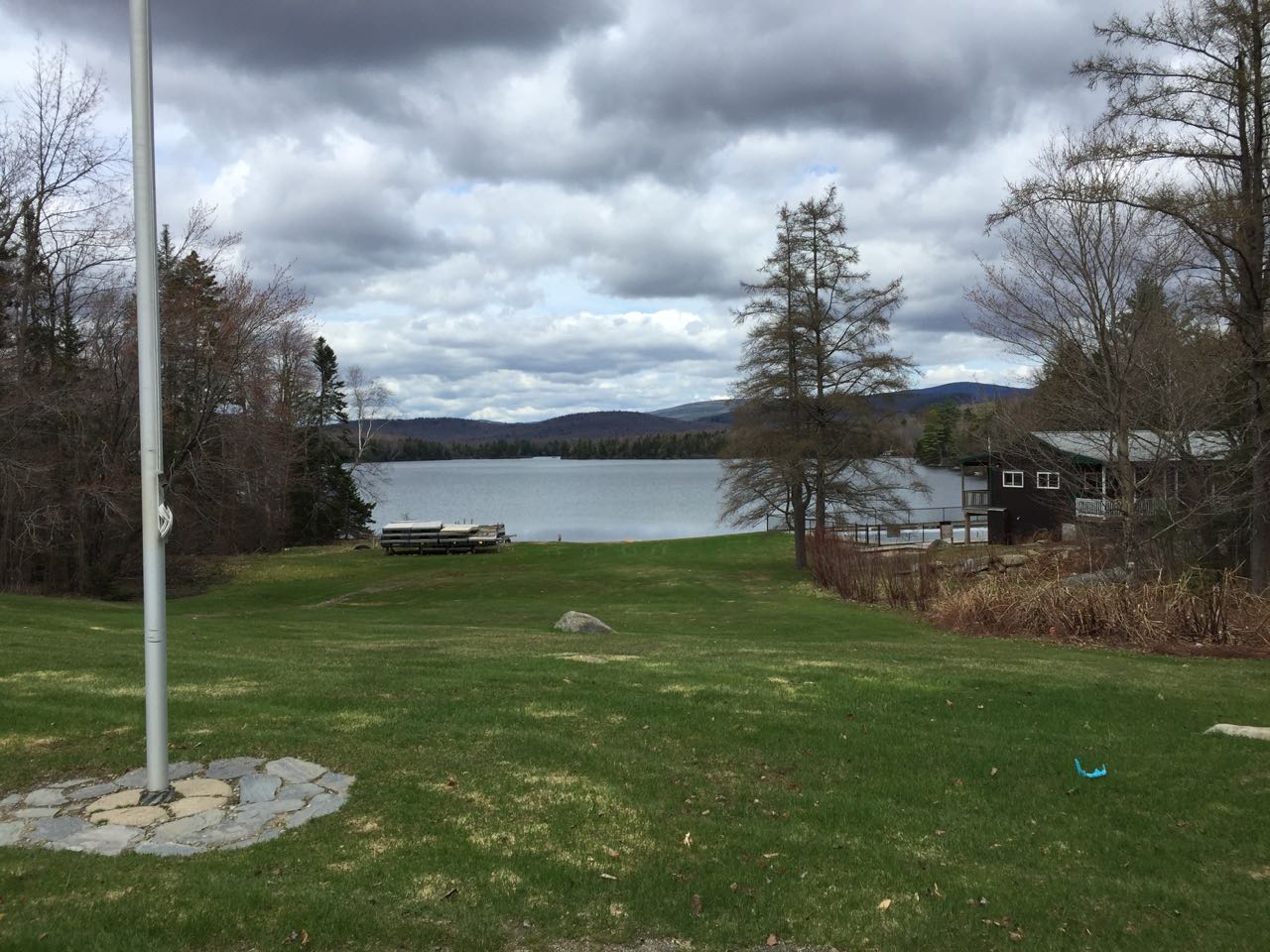
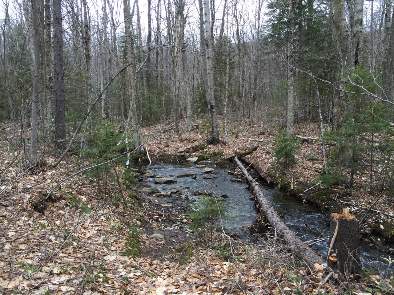
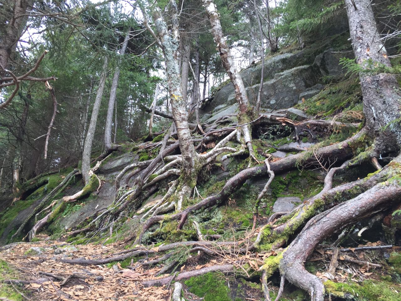
Since hikers are asked to park outside the camp, your hike will begin with a walk down the access road. Head downhill on the road for 0.3 miles, passing various camp buildings and recreation areas. Just before reaching the center of the camp, pass the main office. When the camp is open for recreation, they ask that hikers stop in at the office to sign in. Continue across the camp center, staying to the right on the main road. As you pass by a lawn with a view down to Lake Armington, bear right on a smaller road that heads slightly downhill, then leads past newly-built cabins to a prominent sign marking the start of the Pvt. Ritchie Green Trail, named for a Vietnam war hero. Turn left onto the trail, which immediately crosses a small powerline cut and begins climbing on a wide forest corridor. Note that the trail is not maintained when the camp is closed for the season and may require more care to follow. It heads uphill through open forest, gradually becoming steeper. After about half a mile, the trail swings left toward a plateau. The trail crosses a brook in 0.1 miles and enters an area of overgrown logging roads and clearings. In another 0.15 miles, the trail passes by a wetland on the right at a distance, then climbs 0.1 miles along a section that often has water running over it. It crosses a more open logged clearing with views of the summit ahead, where it may occasionally flood and hikers may have to detour through the woods around the trail. The trail then crosses another small brook and begins to climb, rapidly becoming very steep. You must struggle up the tough grades for 1/4 mile before there is a brief reprieve in a gentler area. In 0.1 miles, the hardwood forest transitions to conifers and the trail attacks the steepest grade yet. Over the next 0.1 miles, it ascends extremely steeply over rocks, then turns sharply to the left and encounters a nearly vertical rock face. This is the most difficult section of the entire trail; you must hold onto trees as you weave your way up and around the ledge. Beyond here, the trail leads up for a short distance, then drops into a small valley before climbing again and leading through a tight spruce corridor to reach the summit in 0.15 miles more.
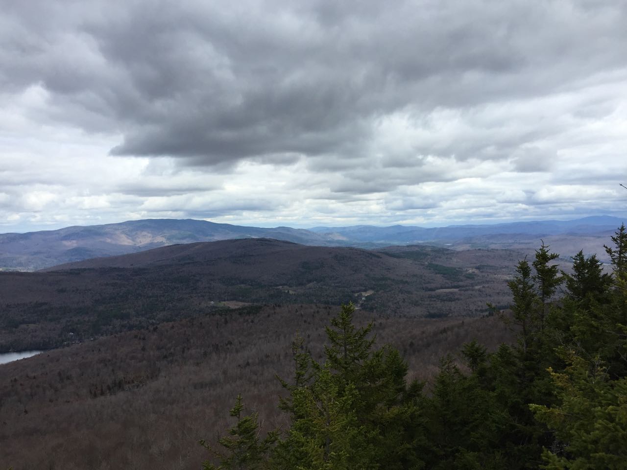
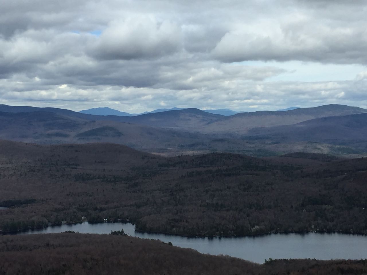
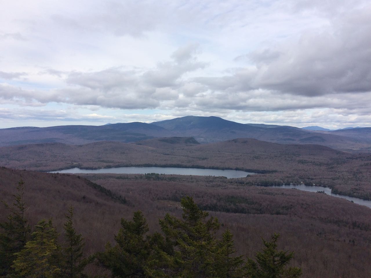
From the unique whitish summit ledges, you enjoy an extensive view of lakes and mountains. To the north, over the nearby shoulder of Piermont, you look toward the Benton Range, with many of their open ledges visible. The long forested ridge of Jeffers Mountain in the middle of the range leads over to the right to Mt. Clough. To the right is the cliff-faced Webster Slide Mountain closer to you, and the majestic Mt. Moosilauke further away. Lake Tarelton stretches across the foreground. To the right of Moosilauke, more distant peaks in the Whites can be seen, including Mt. Osceola, Mt. Tecumseh, Mt. Whiteface, and Sandwich Dome. The next lake over is Lake Armington, which you walked by in the camp. Behind it (and in front of the more distant peaks), Mt. Cushman, Mt. Kineo, and Carr Mountain line up diagonally from left to right. Further over to the right of the long ridge of Carr and beyond the low-lying Sentinal Mountain, you look over the Baker River Valley. Plymouth Mountain and the Tenney Mountain wind farm are seen behind. Furthest over to the right, Mt. Cardigan can be seen in the distance.
Printable directions page